
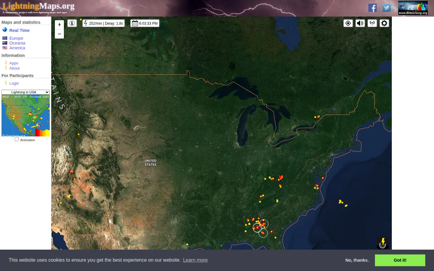
LightningMaps.org turns community-sensed lightning data into a live global map, with separate regional views for Europe, Oceania, and America. It is excellent for storm-curious wandering, provided you treat every glowing dot as interesting data rather than a personal safety alert.
What is Lightning Maps?
The page takes a planet-scale weather event and makes it feel immediate: recent lightning strokes arrive on a map supplied by a worldwide network of volunteer detectors. Regional views and statistics let you narrow the spectacle when one hemisphere is quiet, while an animation option gives the main view its pulse. The machinery behind those dots is part of the charm. Stations timestamp radio signals, central servers compare when those signals arrived, and LightningMaps.org handles the visualization. That community-built chain also explains the rough edges: coverage is stronger where detectors are dense, some strokes are missed, and an occasional location may be wrong.
What you can do there
- View recent lightning strokes on a world map
- Open regional lightning maps and statistics
Why we picked it
Few maps make invisible infrastructure this legible. Lightning Maps connects a flash in the sky to a volunteer sensor network and then back to a dot anyone can follow, turning distant storms into a quietly absorbing piece of live cartography. The regional coverage caveat is real, but it also reveals how the map is made rather than spoiling the view.
How to get the most from it
Start with the real-time view, then jump to Europe, Oceania, or America when you spot a busy patch. Use the animation option to follow the recent sequence, and compare activity across regions instead of treating one missing dot as proof that no lightning occurred. A phone or tablet can use the site's mobile map design when the weather watching moves away from a desk.
Good to know
This is a fascinating weather window, not an emergency-warning service. The project says its data is for entertainment and should not be used to protect life or property, settle insurance questions, or replace a commercial lightning provider. It does not distinguish cloud-to-ground strokes from in-cloud events, and detection varies with station density. The site also discloses Google Maps, Google AdSense, Matomo, and possible third-party cookies.
Open Lightning MapsMore like this
The Pudding

Visual essays that use code, data, and interaction to explain culture unusually well.
Earth Nullschool

A living globe of wind, weather, ocean currents, and atmospheric motion.
The True Size Of…

Drag countries around the map and watch familiar size comparisons fall apart.
MapCrunch

Drop into a random street-level view somewhere in the world and figure out where you landed.